


Results 1 to 1 of 1
-
10-20-2016, 04:07 PM #1Administrator

- Join Date
- Oct 2016
- Posts
- 2,028
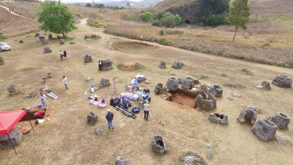
3D Virtual Reality Map Built With Drone
A team of archaeologists from Australian National University and Monash University have utilized drone technology to build a 3D virtual reality map of the Plain of Jars in Laos, one of the most mysterious sites in all of Asia. The virtual reality map was created with CAVE2 technology developed at Monash University, which uses drone footage to create a 3D representation of dig sites. Not only were the archaeologists able to revisit an accurate 3D replica the site, the virtual reality model can also be 3D printed, allowing people to view wondrous relics without damaging the actual artifact. Read more at 3DPrint.com: https://3dprint.com/153146/drone-3d-map-laos/

 Reply With Quote


Please explain to me how to...
Today, 12:15 PM in 3D Printer Parts, Filament & Materials