


Results 1 to 1 of 1
-
01-18-2017, 06:40 PM #1Administrator

- Join Date
- Oct 2016
- Posts
- 2,028
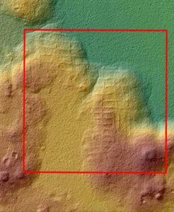
LIDAR Reveals Ancient Superhighways
LIDAR mapping technology was recently deployed in the Guatemalan jungle, and revealed a network of ancient 'superhighways' that once connected pyramids. This important discovery means that the Maya civilization may have rivaled that of the vast Roman empire. Researchers with the archaeological Mirador Basin Project discovered the roads last month. LIDAR technology used in the Mirador Basin made high-resolution 2D and 3D maps, allowing the researchers to get a three-dimensional view of the historic Basin without the canopy of jungle foliage getting in the way. Read more at 3DPrint.com: https://3dprint.com/162011/lidar-sca...mirador-basin/

 Reply With Quote


Extruder not feeding during print,...
04-24-2024, 01:59 AM in Tips, Tricks and Tech Help