


Results 1 to 1 of 1
-
05-26-2015, 12:15 AM #1Administrator

- Join Date
- Jan 2014
- Posts
- 7,697

Using 3D Printing to Visualize Australia's Farmland & More
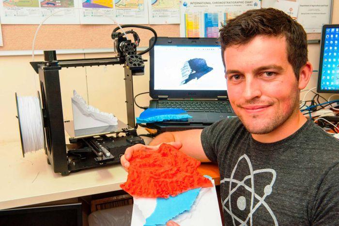
Visualizing the lay of the land with the use of a traditional topographic map can be challenging. However, Nick Wright of the Department of Agriculture and Food, Western Australia (DAFWA) has developed a process of 3D modeling using survey data as well as data provided by NASA to create 3D-printed models of segments of land in Western Australia. Specifically, the models are meant to provide clear representations of hydro-geological relationships, such as the proximity and flow of an aquifer to arable land. Wright pioneered a 3D modeling process and expects the technology will be invaluable in providing visual aids for farmers and other agricultural interests. More details on this story may be found here: http://3dprint.com/67697/3d-printed-topographic-map/
Below is a picture of Wright and one of his 3D Prints:


 Reply With Quote


Ender 3 Neo - Jam Problem
Yesterday, 03:06 PM in Tips, Tricks and Tech Help