


Results 1 to 1 of 1
Thread: 3D Printed Sites for Mining
-
10-15-2014, 12:35 PM #1Administrator

- Join Date
- Jan 2014
- Posts
- 7,697

3D Printed Sites for Mining
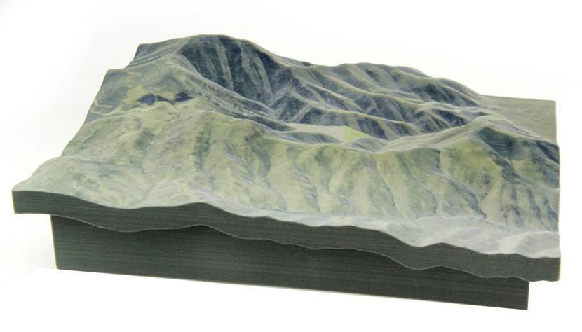
We've seen 3D printed geography before. We have also seen 3D printed earthquake and hurricane maps. Now a company called MineBridge Software is utilizing this technology with help from Whiteclouds and 3DSystems, in order to create detailed 3D models of potential mining sites. This particular model is a mine location in Northern Nevada. Do you guys think this technology will increase the efficiency of such operations? Read and see more at: http://3dprint.com/19373/3d-printed-topography-maps/
Below is an example of one of the 3D prints which were done on a mining site:


 Reply With Quote


QIDI Slicer "Plater" is...
04-12-2024, 02:21 AM in QiDi 3D Printer Forum