


Results 1 to 1 of 1
Thread: Conor O'Kane 3D Prints Ireland
-
04-05-2016, 07:45 PM #1Administrator

- Join Date
- Jan 2014
- Posts
- 7,697

Conor O'Kane 3D Prints Ireland
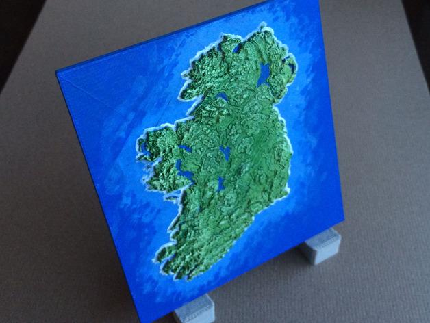
Conor O'Kane used newly available topographical data from the Shuttle Radar Topography Mission (SRTM) to design and 3D print a very detailed and accurate map of his beloved native Ireland. While O'Kane has not lived in Ireland for over a decade, he still retains a fondness for the island and this fondness is expressed in his 3D design and printing work of the map. He has also made the map's file available on Thingiverse, and plenty of other people have tried their hand in 3D printing one as well. Read more at 3DPrint.com: https://3dprint.com/127687/3d-printe...aphic-ireland/


 Reply With Quote


Print not sticking to base plate?
Yesterday, 01:26 PM in General 3D Printing Discussion